
- Home
- Live Blog
- Breaking News
- Top Headlines
- Cities
- NE News
- Sentinel Media
- Sports
- Education
- Jobs
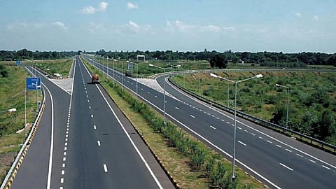
The National Highways Authority of India flagging critical gaps in the mobile connectivity network along the National Highway (NH) network in 424 locations across the country has great significance for the northeast region. The NHAI has sought the intervention of the Department of Telecommunications and the Telecom Regulatory Authority of India (TRAI) to issue appropriate directions to Telecom Service Providers for addressing non-availability of the mobile network connectivity on several stretches of National Highways, particularly on greenfield and remote sections. Official data highlights that as of June 2025, out of 45,934 villages in the region, more than 3800 villages are yet to be covered with mobile connectivity. Expansion of the NH network in the region is a strategic requirement, with the region having 98% international borders and many villages located in remote areas. The NHAI has emphasised public safety implications and strategic significance of the NH network and called for an expeditious and coordinated approach to improve mobile network connectivity on the NH corridors. It has identified 1750 km across the NH network as critically affected due to the non-availability of mobile network connectivity. The primary argument put forward by NHAI in pushing for expeditious extension of mobile coverage to identified locations is that as the NH corridors traverse through remote and rural areas, the absence of dependable mobile network coverage on these sections adversely impacts National Highway operations, emergency response mechanisms and delivery of technology-enabled public services. The NHAI’s request to TRAI to issue necessary directions to telecom operators for dissemination of proactive SMS or Flash SMS alerts at geo-mapped accident-prone locations, including stretches affected by stray cattle movement and other identified hazards, is a timely initiative to prevent road fatalities. If these alerts reach the road users prior to their arrival at such locations, it will enable timely caution and safer driving behaviour, as envisaged by the NHAI, provided the awareness is also generated among road users to take such alerts and road signages and strictly adhere to laid-down traffic norms for safer driving along highways. The stray cattle menace along NH stretches has increased accident risks manifold in Assam, especially along four-lane motorways. Keeping the highways free from stray animals is crucial for the safety of both road users and the animals. The NHAI sharing the list of accident-prone stretches frequently impacted by stray cattle with TRAI alone is not sufficient to address the problem. Shifting the stray cattle to Gaushalas, if owners are not found, needs to be prioritised by the NHAI in coordination with the local administration so that road users can drive safely. Ironically, a section of cattle owners can be seen using the median dividers along highway stretches in the state as grazing strips and tying the animals with rope long enough to allow such cattle to wander into the carriageway, increasing accident risk. Persistent use of the dividers as grazing strips by some livestock owners living along highways speaks volumes about the ineffectiveness of road safety awareness drives in changing such risky behavioural practices and calls for innovative efforts to overcome the challenge. The NHAI insists that its efforts to ensure that the NH network is not only physically well-connected but is also digitally enabled align with its broader objective of delivering safe, efficient and user-centric NH infrastructure for citizens across the country. However, the gaps in mobile connectivity along highway stretches are also reflective of a lack of effective coordination between the Ministry of Road Transport and Highways and the Ministry of Telecom to address the mobile connectivity issue right from when greenfield highway corridors, motorways and expansion of highways are planned to be implemented. Highway projects, particularly in the region, take several years due to time overruns, and smooth coordination and meticulous planning on mobile coverage along the NH network can ensure that highway stretches are fully covered with mobile connectivity and high-speed internet connectivity before commissioning of a particular stretch of a highway project. Expeditious completion of all projects implemented by the Digital Bharat Nidhi (DBN) for expansion of telecom connectivity through installation of mobile towers in the rural, remote and border areas of the northeast region under the Comprehensive Telecom Development Plan is crucial for providing mobile connectivity to uncovered villages and areas along the NH network in the region. The push for accelerating the project work must also come from the state governments, local bodies, and local communities. Improved mobile connectivity along a highway is not only essential for improving the safety of drivers and passengers of vehicles using it but also for facilitating people along it to promptly inform the emergency response authorities whenever an accident occurs so that ambulances and rescue teams can reach the spot quickly and save lives. Improved digital connectivity along the NH network can also facilitate reminding people in remote and strategic areas about road safety and about any traffic disruption caused by landslides or any other cause.
