
- Home
- Live Blog
- Breaking News
- Top Headlines
- Cities
- NE News
- Sentinel Media
- Sports
- Education
- Jobs
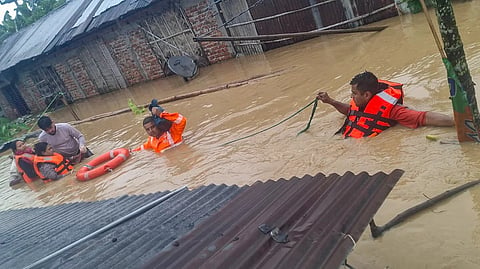
Assam Chief Minister Dr. Himanta Biswa Sarma said on Saturday that the government was focusing on innovative and sustainable solutions to tackle the perennial flood problem in the state. He is also on record saying the government wants to solve the flood problem in a scientific way. Keeping the flood problem in mind, the Chief Minister has also appealed to the IITs, IIMs and universities to work together on this matter and come up with innovative and sustainable solutions to the floods that can provide accurate satellite imagery the government can implement to tackle the problem. As reported in the Sunday edition of this newspaper, the government would approach the Centre for funds once a concrete plan is made available from the academic community. What is most significant in the Chief Minister’s statement is that his government is also looking forward to a plan that can provide accurate satellite imagery. The issue of floods coming down from the adjoining hill states like Arunachal Pradesh, Nagaland, Manipur, Meghalaya and Mizoram, and the Himalayan kingdom of Bhutan can also be tackled. Dr Sarma must be appreciated for looking forward towards a holistic approach to the problem of floods by taking into account the entire Brahmaputra Basin. Technically speaking, the Brahmaputra basin extends over an area of 5,80,000 sq km, right from its source in the Kailash Mountains in Tibet (China) to its outflow to the Bay of Bengal in Bangladesh. The catchment area of the mighty Brahmaputra extends over 2, 93,000 sq km in Tibet alone, followed by 2,40,000 sq km in India and Bhutan and the remaining 47,000 sq km in Bangladesh. What must always be kept in mind while discussing the flood problem of Assam is that the state is in the mid-riparian region of the Brahmaputra, with Tibet (China) and Bhutan constituting the upper riparian region and Bangladesh constituting the lower riparian portion. Excluding the large development projects centred around the Brahmaputra in China, which the Government of India must address, it is important to note that almost all 104 tributaries of the Brahmaputra (except for about a dozen that originate in Bhutan and Myanmar) actually begin in the four neighbouring states of Arunachal Pradesh, Nagaland, Manipur, Mizoram, and Meghalaya. Even a rough overview will clearly indicate that various kinds of activities happening to the ecology and environment in these neighbouring states directly affect the flow and character of the Brahmaputra and its tributaries. Activities occurring in the four hill states and Bhutan are contributing to and are solely responsible for increasing the unpredictability of the Brahmaputra and its tributaries. Many activities occurring within the state of Assam are also contributing to the mighty river and its tributaries. While the Government of Assam is responsible for addressing the factors within the state that negatively impact the Brahmaputra and its tributaries, it is also its duty to address trans-border river issues with neighbouring states. Ideally, discussions between the Chief Ministers of Assam and Nagaland should have been held more than once after the unprecedented floods caused by the rivers originating in that hill state. Furthermore, there is a full-fledged ministry in the central government to look after the development of the Northeastern region. By now, this ministry should have independently initiated an investigation into the numerous allegations that serious ecological and environmental degradation in the neighbouring hill state of Nagaland has significantly contributed to the unprecedented floods in the three upper Assam districts. To provide an indication that these allegations could be true, one can cite one unofficial report published in a London-based self-proclaimed “independent non-profit” e-magazine called “Dialogue Earth” in 2021, which said that topsoil erosion in Nagaland averages roughly 30.62 tonnes per hectare every year. This rate, it said, was three times more than the national average of 10.2 tonnes. It had also said that about 70% of Nagaland’s hilly terrain faces erosion risks driven by intensive slash-and-burn (jhum) farming, heavy monsoon downpours, and large-scale road infrastructure expansion. For some reason, the report did not mention the rampant cutting of earth in Nagaland, which significantly contributes to topsoil erosion in the state. There are several scientific agencies of the Government of India that can provide accurate satellite imagery of the rapid earth-cutting and deforestation taking place across the Northeastern region, including Assam, as well as in Bhutan, for the past 10 to 20 years. These pictures will be sufficient to identify the root causes of floods in Assam. As far as innovative scientific and permanent solutions are concerned, the responsibility of finding them should also rest with the Government of India.
