
- Home
- Live Blog
- Breaking News
- Top Headlines
- Cities
- NE News
- Sentinel Media
- Sports
- Education
- Jobs
OUR CORRESPONDENT
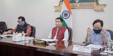
ITANAGAR: Arunachal Pradesh Chief Minister Pema Khandu Tuesday emphasized having a GIS-based and scientifically approved drainage master plan for the Itanagar Capital Region to mitigate flash floods and landslides often witnessed every year during the monsoons.
Chairing a meeting on a master plan by the Town Planning department here, Pema Khandu while saying that almost 70 per cent of causes for floods are man-made and only about 30 per cent is natural, suggested for a mechanism to be developed to stop rampant earth cutting, encroachment of natural streams and disposal of garbage into drains.
He made it clear that construction of roads and drainages must be included in one package as one project, official sources informed.
"Construction of roads must also include construction of drains along the road by the same executing agency and the contractor," he said.
Khandu also expressed concern over the confusion in rules of business amongst engineering departments like urban development, PWD, RWD, PHED, WRD, which has led to overlapping and duplicity of several projects besides lack of maintenance of completed projects.
He directed the chief secretary to immediately bring clarity in business rules and roles of all such departments, especially those which have engineers in their payroll.
"It must be made clear through a notification to the departments of their roles, jurisdiction and responsibilities. And to avoid overlapping and duplicity of projects Town Planning department can be made the nodal agency to give clearance to all such proposed projects," the chief minister said.
Responding to the GIS master plan on the drainage system in the capital complex, prepared by Guwahati-based En-Geo Consultancy & Research Center, Khandu directed the department to go through the master plan minutely and in detail. "The plan is a roadmap to 'what we need to do'. But now we have to concentrate on 'how to do'. This needs brainstorming and coordination amongst all stakeholders which include the Itanagar Municipal Council and the Smart City Project besides the line departments," he pointed out.
To give the plan a trial, Khandu asked IMC Mayor Tame Phassang and capital MLA Techi Kaso to suggest two sectors – one each in Itanagar and Naharlagun, for construction of a drainage system based on GIS mapping.
A GIS-based Itanagar development master plan, a roadmap for the development of the capital region keeping in view the scenario of the next 25 years, was also presented to the chief minister on the occasion, sources said. The master plan includes the identification and development of residential and industrial areas, sewerage and drainage, solid waste management, tourism, commercial corridor, public and semi-public spaces, etc. It also proposes a detailed plan for new roads, footpaths, interconnecting bridges, flyover, alternative routes, improvement of road junctions, etc.
Deputy Chief Minister Chowna Mein, Urban Development Minister Kamlung Mossang, Itanagar MLA Techi Kaso, Pasighat MLA Kaling Moyong, Mayor Tame Phassang, Chief Secretary, Finance Commissioner, Planning Commissioner, Secretary UD and other officials of UD and Town Planning attended the meeting.
Also Watch:
