
- Home
- Live Blog
- Breaking News
- Top Headlines
- Cities
- NE News
- Sentinel Media
- Sports
- Education
- Jobs
Move undertaken after 55 years
771 hamlets to be covered initially
STAFF REPORTER
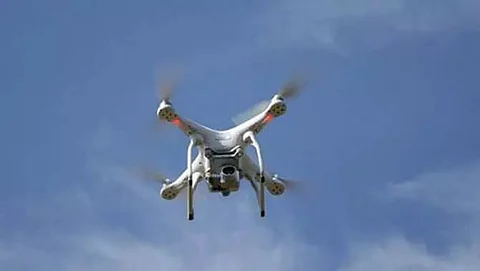
GUWAHATI: In yet another historic move of the present BJP-led state government, the maps of land of all villages are being digitally prepared using drones for the maiden time.
Significantly, this initiative has been undertaken after a long gap of 55 years. The previous survey was carried out — manually — way back in 1965.
It has been learnt that many state hamlets even do not have such area maps while the old area maps of several other hamlets got damaged owing to various natural reasons over time.
Following the direction of Chief Minister Himanta Biswa Sarma, the ball has been set rolling by the Revenue & Disaster Management Department with help of the Directorate of Land Records.
Talking to The Sentinel on Monday, Minister of Revenue & Disaster Management Department Jogen Mohan said, "There are approximately 18,700 villages in Assam. We will utilize drones to survey all these villages under 'Mission Basundhara'.
He added, "A total of 771 villages have been included in the first phase. These are in the districts of Dibrugarh and Tinsukia. None of them has any area maps. The target to complete these maps is on or before May 10, 2022. The target has also significance: The present state government will be completing one year on this day."
On the use of drones, the Minister explained, "Each of the drones requires 15 minutes to survey one square kilometre of land. Had this job been done traditionally (using manpower at the ground level), it would have taken years and years. Of course, even drones will take some time. But it will not be as time-consuming as the manual one."
The Minister further informed that Moran under Dibrugarh District will be the first Revenue Circle to undergo the drone survey. It was launched on Sunday.
He added, "The prime objective of 'Mission Basundhara' is 'Mor Mati, Mor Adhikar' (My Land, My Right). With the preparation of the drone-initiated digital maps, all land-related issues will be easily resolved."
Also Watch:
