
- Home
- Live Blog
- Breaking News
- Top Headlines
- Cities
- NE News
- Sentinel Media
- Sports
- Education
- Jobs
NESAC recommends erosion-control measures in identified hotspot districts and integrated river basin management of the Brahmaputra and the Barak, considering both main channels and tributaries.
Staff Reporter
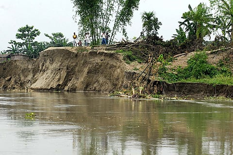
GUWAHATI: The North Eastern Space Applications Centre (NESAC) has recommended targeted erosion-control measures in identified hotspot districts and integrated river basin management of the Brahmaputra and the Barak, considering both main channels and tributaries. NESAC conducted a detailed study on erosion by the Brahmaputra, the Barak and their tributaries from 2016 to 2024. The study found severe erosion in these two river systems.
NESAC is a regional space centre established by a joint initiative of the Department of Space, Government of India, and the North Eastern Council to expedite the usage of remote sensing technology to discover natural minerals uncovered in the North Eastern states of India and to promote overall growth of the North Eastern states of India using space science and technology.
According to the findings of the NESAC's study, two river systems eroded 67,580.55 hectares of land, including 30,289.45 hectares of arable land, from 2016 to 2024 in the state. The erosion was highest - 26,627.89 hectares, including 10,431.53 hectares of arable land - during this period from 2018 to 2020.
According to the NESAC report, riverbank erosion is a recurring and severe hazard across Assam, primarily driven by the highly dynamic nature of the Brahmaputra River and its tributary systems. The continuous shifting of river channels not only alters the physical landscape but also leads to substantial loss of agricultural land, thereby affecting livelihoods and food security. Recognizing the urgency of this issue, the study provides a comprehensive assessment of riverbank migration and associated agricultural land loss across major river systems in Assam.
The 9th NESAC society meeting suggested utilising space technology for developmental and management planning in Northeast India. NESAC conducted a study on "Bankline Migration Studies of Brahmaputra, Barak and Selected Tributaries" under the plan of action for the period 2016-2022. The study has now been extended to include 2024 data under NER-DRR due to the ongoing persistence of riverbank erosion. This study analyses the Brahmaputra, Barak, and selected tributaries over the period 2016-2024 using multi-temporal satellite data. The Normalised Difference Water Index (NDWI) was employed to extract river extents consistently across years, enabling accurate riverbank delineation. Through spatio-temporal analysis, erosion patterns and agricultural land losses were quantified and mapped at the district level.
The findings reveal that districts such as Dhubri, Barpeta, Dibrugarh, and Sonitpur consistently experienced high erosion during 2016-2024, with Dhubri recording erosion exceeding 2,693 ha from 2016 to 2018. A significant rise in erosion intensity was observed during 2018-2020 due to severe floods and prolonged monsoon conditions, while a relative decline was noticed during 2022-2024, indicating temporary channel stabilisation. Agricultural land loss was particularly severe in Nalbari (80.89%), Goalpara (70.49%), Morigaon (63.34%), and Barpeta (62.44%), highlighting the vulnerability of floodplain agriculture," the report said.
The report further said, "Tributary-wise analysis identified the Subansiri, Beki, Manas, and Dhansiri rivers as major erosion hotspots. During 2016-2018, substantial agricultural land loss occurred in Lakhimpur (607 ha) and Barpeta (545 ha), while severe erosion was recorded in Lakhimpur (2071 ha) and Sonitpur (819 ha). Along the Barak River, the highest erosion was observed in Cachar district during 2016-2018 (53.38 ha), followed by a declining trend in subsequent years, with no significant erosion reported from 2022 to 2024.
Agricultural land loss emerged as a critical concern, particularly in districts like Barpeta, Dhubri, Nalbari, Morigaon, and Goalpara, where agricultural activities are concentrated along vulnerable floodplains. The study further identifies major tributaries, including the Subansiri, Beki, Manas, and Dhansiri rivers, as significant contributors to localised erosion and agricultural land loss. Overall, this work provides valuable insights for policymakers, planners, and disaster management authorities to develop sustainable strategies for mitigating erosion impacts and enhancing agricultural resilience in flood-prone regions of Assam.
Also Read: AASU urges Assam government to adopt zero-tolerance crackdown to instil fear in drug syndicates
