
- Home
- Live Blog
- Breaking News
- Top Headlines
- Cities
- NE News
- Sentinel Media
- Sports
- Education
- Jobs
Staff Reporter
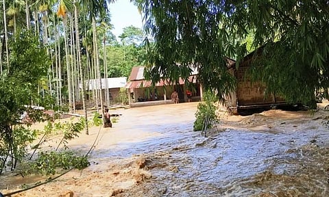
Guwahati: The North-Eastern Space Applications Centre (NESAC) revealed in a Preliminary Assessment Report that incessant rainfall early on July 19, 2026, triggered the devastating landslide in Mon, Nagaland. The water run-off from the continuous and intense rainfall in Nagaland led to devastating floods in the Sivasagar and Charaideo districts of Assam, in areas that had never experienced such floods before.
The Assam government also stressed this fact before the Inter-ministerial Central Team that visited Assam to take stock of the situation. The Government of Assam informed the Central Team that the recent flood situation in these districts was totally unprecedented. The districts of Charaideo and Sivasagar were never flood-prone. However, the exceptionally high rainfall on July 19, 2026, which was 181% above normal in Nagaland-particularly in Mokokchung, where it reached 493% above normal; Wokha, at 108% above normal; and Mon, at 45% above normal-along with localised extremely heavy rainfall in Charaideo and Sivasagar districts, exacerbated the inundation across the affected areas.
Recently, NESAC, under the Department of Space, Government of India, published a report titled "Preliminary Assessment Report on the Mon Landslide, Nagaland (19 July 2026)." The report states that a devastating landslide triggered by incessant rainfall struck Walo Ward in Mon town, Nagaland, early on Sunday, claiming the lives of at least eight people, including children, and injuring 12 others. The landslide, which occurred at around 6:30 a.m., swept away more than 40 houses and severely damaged several others, burying residents beneath tonnes of debris.
This brief report has been prepared to examine the immediate causes of the devastating landslide events that occurred across the state of Nagaland. "The affected site in the Mon district of Nagaland is characterised by moderate to very steep terrain, with DEM-derived slope angles ranging from approximately 30° to 45°. The slope is composed predominantly of weathered lateritic materials, which generally exhibit an angle of repose of 30°-40° under relatively dry, granular conditions. However, the effective angle of repose varies considerably with moisture content, degree of weathering, particle characteristics, and compaction. Prolonged or intense rainfall likely increased the moisture content and pore-water pressure within the weathered slope materials, thereby reducing their shear strength and effective angle of repose. These changes in geotechnical properties would have significantly decreased slope stability, ultimately triggering the slope failure," the report states.
Regarding the rainfall condition prior to the event, the report said that the cumulative rainfall recorded at the IMD Bihubar station, the nearest weather station to Mon Township, ranged from 115.1 mm to 200 mm during the period from 0830 IST on July 18, 2026, to 0830 IST on July 20, 2026. In contrast, the Mokokchung IMD weather station, located farther from the township, recorded more than 400 mm of cumulative rainfall over the same period.
The landslides in the upper catchment areas of Nagaland were triggered by widespread and prolonged rainfall, and this rainfall event subsequently resulted in the devastating floods in Upper Assam districts which are downstream of the Dikhow, Disang and Jhanji rivers, starting July 19, 2026.
Also Read: Assam-Arunachal Tensions Flare at Check Gates as TMPK Suspends Blockade for 48 Hours
